Incoming rain set to dampen the school holidays may be a taste of downpours expected over October, amid a gradual shift toward La Nina conditions.
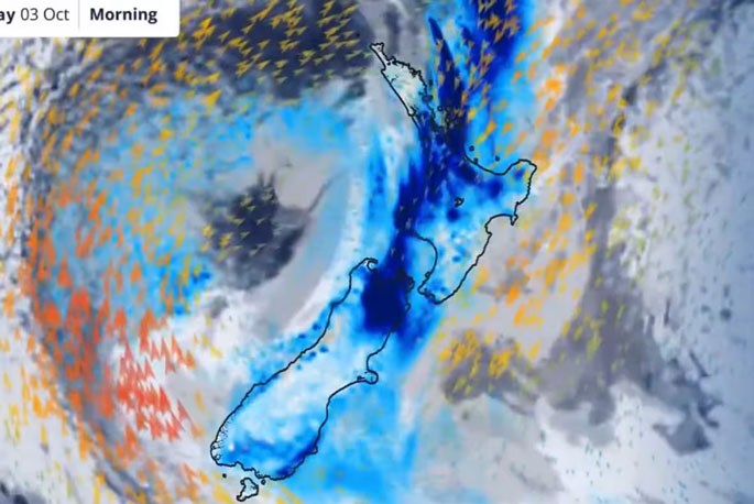
A moisture-packed weather system is forecast to sweep in from the Tasman Sea early tomorrow, bringing heavy falls and strong gusts to Auckland, before calming to showers later in the week.
The South Island’s West Coast is expected to bear the brunt of the rain, with MetService heavy rain watches in place from Westland to Tasman for Wednesday.
“It’s likely some of these will be upgraded to Orange [rainfall] warnings and areas in the North Island may be added,” MetService meteorologist Lewis Ferris said.
In the Bay of Plenty, it was possible more rain could fall there in 36 hours from Thursday than in all of its notably dry September.
It comes as Niwa forewarns of potential for more downpours throughout October, amid an emerging “La Nina-like“ pressure pattern raising the odds of big rain events.
”Some of those events could be fairly moist,” Niwa meteorologist Ben Noll said.
“This week ... we have northerly winds pushing a lot of moisture on to the country and lots of regions getting a decent amount of rain.
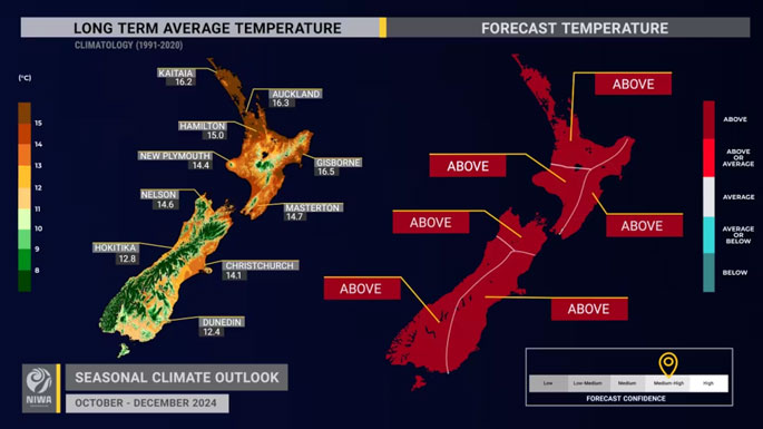 Niwa’s August-October seasonal outlook states there is a 55% chance of temperatures being above average in the central North Island region, which includes Taranaki, Whanganui, Manawatū, Horowhenua and Greater Wellington. Photo / Niwa.
“I’d say it’s a very good indication of the weather we’ll probably be getting over the weeks and months ahead.”
Niwa’s just-issued climate outlook for the rest of 2024 gave a 60-70% chance of our fourth La Nina this decade – the climate driver had a hand in 2023′s extreme summer – forming by December.
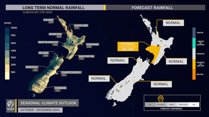 Rainfall has an equal chance of being near normal or below normal, according to the Niwa seasonal outlook for October-December. Photo / Niwa.
The outlook picked near- or below-normal rainfall for the west of the North Island, near-normal amounts elsewhere, and above-average temperatures across the country.
Dry spells could develop – especially in the west of both islands – and more frequent northeasterly winds over November and December could lead to more hot days with highs above 25C.

0 comments
Leave a Comment
You must be logged in to make a comment.