
A severe thunderstorm watch is now in place for many places around the North Island, including the Bay of Plenty.
A series of active fronts preceded by a strong and moist northeast flow is expected move over the North Island during Thursday morning.
About Coromandel Peninsula, Bay of Plenty and the far northwest of Gisborne/Tairawhiti, there is a moderate risk of some thunderstorms being severe between 1am and 10am on Thursday, producing localised downpours of 25 to 40 mm/h, the MetService said in its latest weather update,
"This risk should ease in Coromandel Peninsula around 7am."
The MetServie said these downpours could occur with or without thunderstorms.
Heavy rain warnings, thunderstorms, snow, wind.
— MetService (@MetService) October 2, 2024
There's a fair bit to cover in the severe weather update today. https://t.co/6eC6ODqX8L
"Rainfall of this intensity can cause surface and/or flash flooding, especially about low-lying areas such as streams, rivers or narrow valleys, and may also lead to slips. Driving conditions will also be hazardous with surface flooding and poor visibility in heavy rain.
"Some of these thunderstorms may also be squally, and produce strong wind gusts of 90 to 110 km/h or possibly stronger. Wind gusts of this strength can cause some structural damage, including trees and power lines, and may make driving hazardous."
A Severe Thunderstorm Watch means conditions are favourable for severe thunderstorms in and close to the watch area.
"People in these areas should be on the lookout for threatening weather conditions and monitor for possible Severe Thunderstorm Warnings."
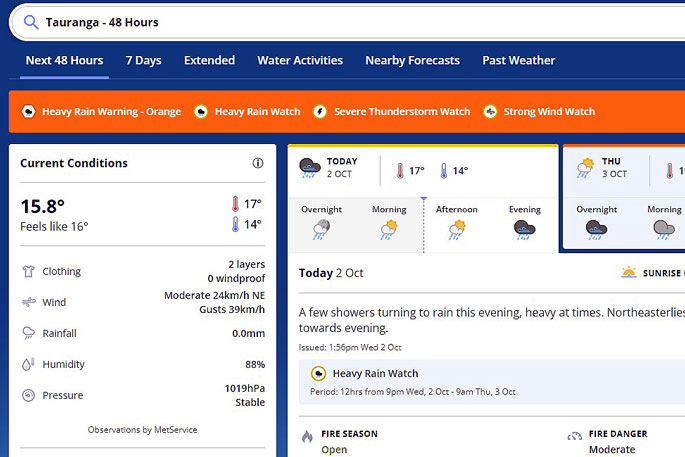 Image: MetService.
MetService Severe Thunderstorm Watch
Area: Coromandel Peninsula, Waikato, Bay of Plenty, Rotorua, Taupo, Gisborne, Hawke's Bay
Valid: 9 hours from 1am Thu 3 Oct to 10am Thu 3 Oct
Area: Northland, Auckland, Great Barrier Island, Waikato
Valid: 9 hours from 8pm Wed 2 Oct to 5am Thu 3 Oct

0 comments
Leave a Comment
You must be logged in to make a comment.