People are being warned to expect some more showers, and potential isolated thunderstorms, in the lead up to Christmas Day.
In it's latet weather update, WeatherWatch says the above prediction is possible on Monday and again on Christmas Day.
Christmas Eve is looking more settled, said the weather organisation.
See below for a full run on the weather foreast from today until Christmas Day.
MONDAY
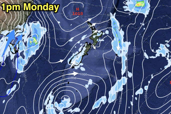
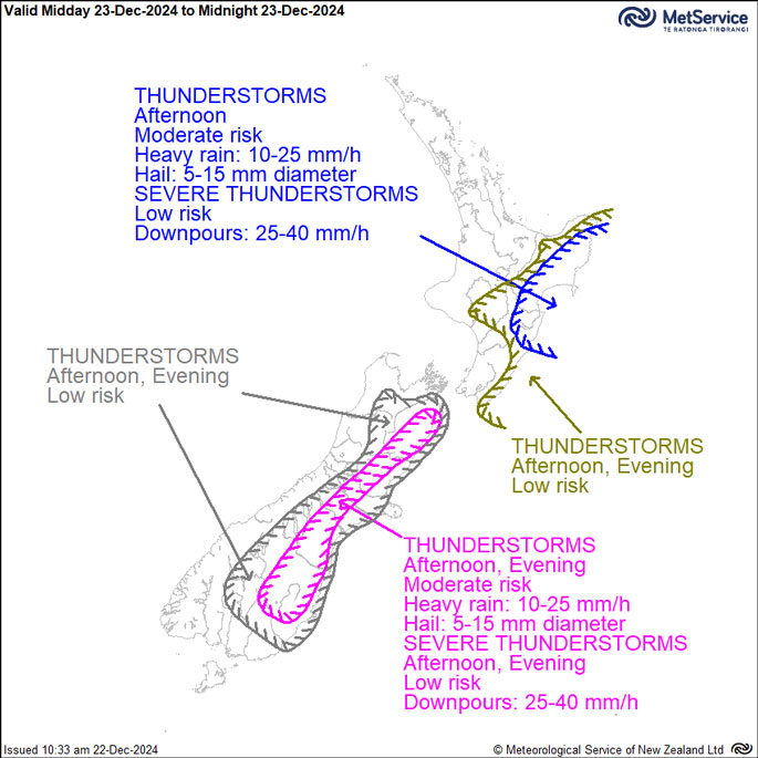
Showers, some heavy with possible isolated lightning are expected to form over both main islands on Monday.
These are most likely to form inland along the eastern half of NZ, down to Otago and Southland. Again they will be hit and miss with large dry areas around them.
Other showers are also possible off the Tasman Sea in the west and isolated ones may also be a bit heavy. Track on rain radar if rain matters to you.


TUESDAY / CHRISTMAS EVE
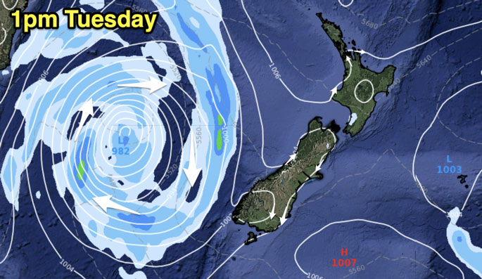
Tuesday is an especially good day for those at home, travelling, on holiday or preparing for people to arrive with light winds and mostly dry summer weather around the country.
A few isolated showers are possible. As you can see from the map below a large low is forming over the Southern Tasman Sea due to a cold southerly that has popped up around Tasmania.
That low should weaken as it moves into NZ over Wednesday and Thursday - but brings some wet weather then.

WEDNESDAY / CHRISTMAS DAY
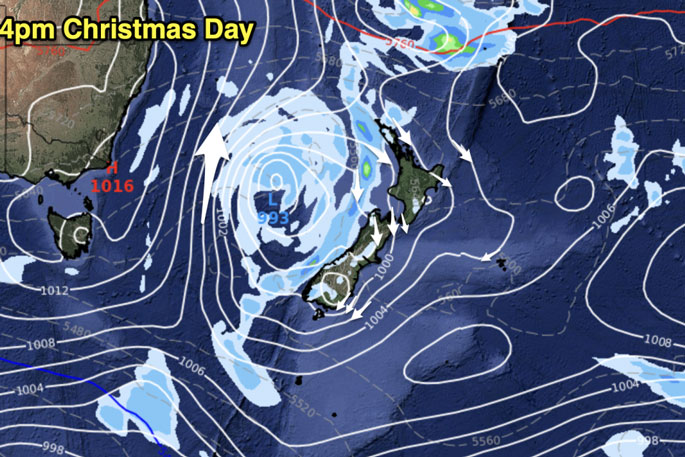
Christmas Day is looking to start off dry in many regions, and for some it will be dry all day.
An incoming low pressure zone means rain over the Tasman Sea is heading our way.
It will likely arrive on the West Coast and the Far North initially, then drift in to more regions in northern and western NZ as the day progresses.
It's possible heavy downpours will also form during the day bringing the risk of thunderstorms in both main islands.
Where they precisely form may not be known until Tuesday or even the day itself - as is often the nature with daytime heat showers (and light winds can cause them to drift).
Risks are in both islands for downpours in the afternoon or evening - and we'll have more details on Monday - or maybe not until Tuesday - locking this detail in.


0 comments
Leave a Comment
You must be logged in to make a comment.