Heavy rain and possible thunderstorms are being forecast for the Bay of Plenty today, as a severe weather warning remains in place for the region.
The rain is expected to continue through tomorrow and Friday.
'Rainfall accumulations could exceed 200mm over Bay of Plenty and Taupo over 45 hours from late Wednesday morning, with lesser amounts in other areas,” says a statement from the MetService.
'Further, Cyclone Cook is expected to cross from Coromandel Peninsula to Wellington during Thursday evening and Friday morning with further heavy rain, large swells and an area of damaging severe gales.”
The precise track of the low centre may change as the cyclone approaches, but it's likely that a number of regions in the North Island will be affected, and additional warnings and watches for both heavy rain and severe gales will probably be issued on Wednesday.
'People should be aware that the heavy rain forecast will cause rivers and streams to rise rapidly, and may cause flooding and slips.
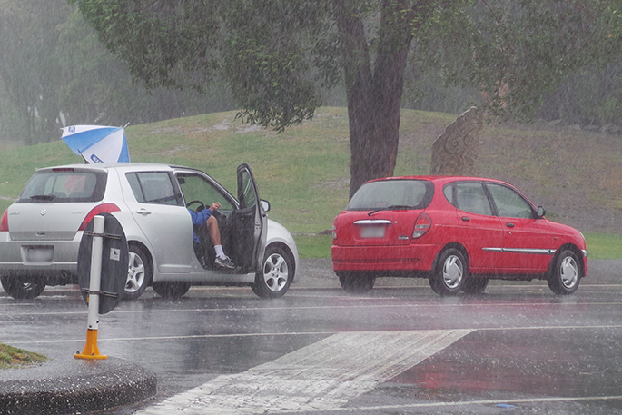
'Driving conditions could also be hazardous, so people will need to take extra care on the roads, and even consider altering their Easter travel plans.
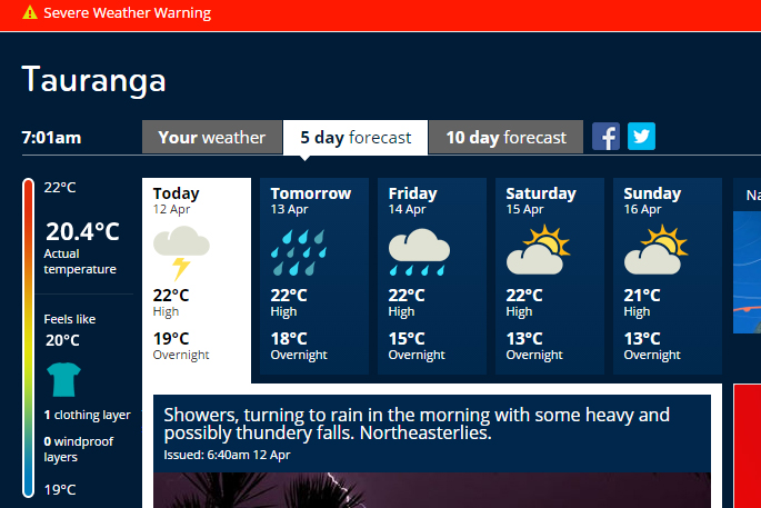 The MetService's five day forecast for Tauranga. Image: MetService.
HEAVY RAIN WARNING
AREA/S AFFECTED
Coromandel Peninsula, Bay of Plenty and Taupo
FORECAST
Periods of heavy rain are expected from late Wednesday morning into Friday. In the 45 hours from 9am Wednesday to 6am Friday, 200 to 250mm is forecast to accumulate. Maximum rainfall rates 30 to 40mm with thunderstorms possible.
AREA/S AFFECTED
Auckland, including Great Barrier Island
FORECAST
Heavy rain is expected to develop Wednesday morning. In the 36 hours from 9am Wednesday to 9pm Thursday, 120 to 160mm is forecast to accumulate. Maximum rainfall rates 30 to 40mm per hour with thunderstorms possible.
AREA/S AFFECTED
Northland
FORECAST
Heavy rain is expected to develop Wednesday afternoon. In the 27 hours from 3pm Wednesday to 6pm Thursday, 110 to 150mm is forecast to accumulate, especially in the east. Maximum rainfall rates 30 to 40mm per hour with thunderstorms possible.
AREA/S AFFECTED
North Otago, Dunedin and Clutha
FORECAST
Rain is expected to become heavy tomorrow morning. In the 27 hours from 3am Wednesday to 6am Thursday, 80 to 120mm is forecast to accumulate. Maximum rainfall rates 15mm per hour.
FREEZING LEVEL: Above 3000 metres.
AREA/S AFFECTED
Westland
FORECAST
Heavy rain is expected to ease Wednesday morning. In the 11 hours from 9pm Tuesday to 8am Wednesday, expect 50 to 80mm to accumulate about the ranges with lesser amounts in lower areas. This amount is in addition to what has already fallen. Maximum rainfall rates 15 to 20mm per hour.
FREEZING LEVEL: Above 3000 metres.
AREA/S AFFECTED
Buller
FORECAST
Heavy rain is expected to ease late Wednesday morning. In the 14 hours from 9pm Tuesday to 11am Wednesday, expect 70 to 110mm to accumulate about the ranges with lesser amounts in lower areas. This amount is in addition to what has already fallen. Maximum rainfall rates 15 to 20mm per hour.
FREEZING LEVEL: Above 3000 metres.
AREA/S AFFECTED
Nelson
FORECAST
Heavy rain is expected to ease early Wednesday afternoon. In the 17 hours from 9pm Tuesday to 2pm Wednesday, 150 to 200mm is forecast to accumulate about the ranges, and lesser amounts in lower areas. This amount is in addition to what has already fallen. Maximum rainfall rates 30 to 40mm per hour.
FREEZING LEVEL: Above 3000 metres.
AREA/S AFFECTED
Richmond and Bryant Ranges, also the Marlborough Sounds
FORECAST
Heavy rain is expected to ease Wednesday afternoon. In the 19 hours from 9pm Tuesday to 4pm Wednesday, 80 to 110mm is forecast to accumulate. Maximum rainfall rates 25mm per hour.
FREEZING LEVEL: Above 3000 metres.

0 comments
Leave a Comment
You must be logged in to make a comment.