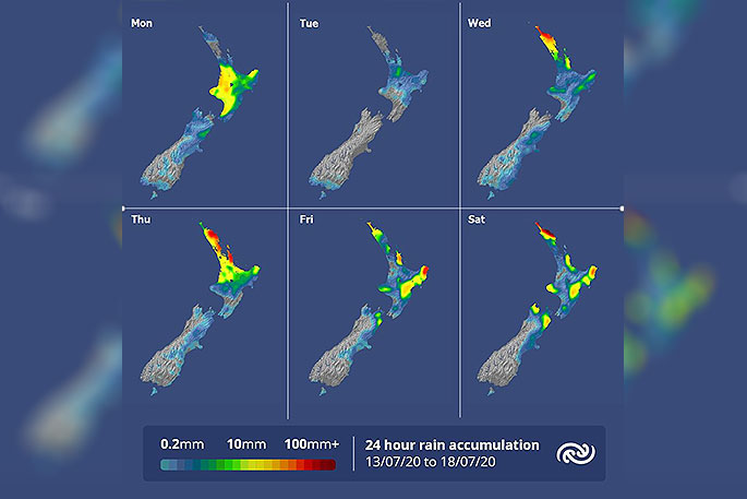
A weakening rain band over the central North Island will continue to sit frustratingly south of Auckland dams in need.
The MetService is keeping an eye on a low pressure system brewing in the Tasman Sea, which is set to bring some rain to the Auckland area from Wednesday.
'A gloomy start is expected for the upper North Island on Tuesday with patchy drizzle and areas of fog,” says MetService Meteorologist April Clark.
'However, a new low system takes control of the weather for these northern regions from Wednesday with a warm front forecast to sink south, bringing rain with some heavy falls and blustery northeasterlies.”
The warm front becomes slow moving during the latter half of the week, which means rain is expected to be prolonged for many areas north of Hawke's Bay that are exposed to the east.
Another front delivered by low in the Tasman is set to bring another bout of rain from Friday, adding to the forecast rain accumulations over the upper North Island.
'Elsewhere, the eastern coasts north of Christchurch are also looking to be affected by this low system with onshore northeasterlies bringing cloud and light showers.
'Unfortunately, this coastal cloud will be bad news for people in those areas looking to observe Matariki in the predawn sky this week.
'The northeast flow does mean ideal conditions for a school holiday excursion up to the South Island Ski fields.”
The western coasts of the South Island are looking to hold their ‘sunshine coast' title, coined last week, with generally dry and fine conditions forecast there this week too.


0 comments
Leave a Comment
You must be logged in to make a comment.