A settled day of weather is looking promising for most places this Christmas.
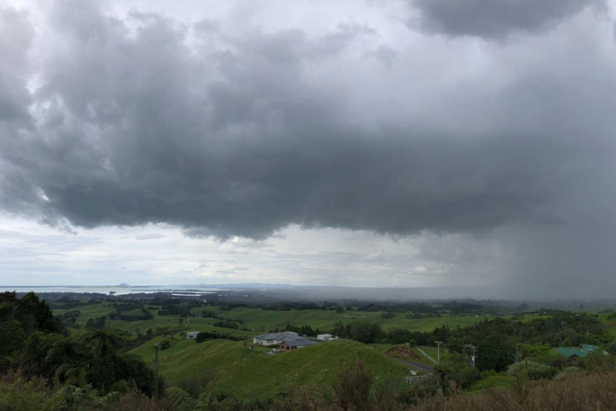
But the MetService says there's still plenty to happen before then with a risk of thunderstorms and downpours across the North Island today.
A low pressure system is meandering in the Tasman Sea for most of this week, which is pushing humid air onto the North Island.
High humidity combined with heating during the afternoons work together to create a favourable environment for thunderstorm development, and today is the day when this risk is greatest.
The area with the highest risk of experiencing thunderstorms and localised downpours today is over the North Island from Tauranga southwards, excluding the western coastline south of Cape Egmont.
"Downpours from thunderstorms are bursts of heavy rain falling at a rate of more than 25mm per hour. Such high amounts of rain falling during a short period can cause surface or flash flooding in any places where this may happen," says MetService meteorologist Dan Corrigan.
"These conditions, along with poor visibility, make driving hazardous as well.
"The tricky part is that it's nearly impossible in this kind of weather situation to pinpoint exactly where each thunderstorm cloud will develop and move. Not everywhere will be affected by a thunderstorm, and any resultant downpours will be localised.
"For people in the North Island, looking at the rain radar on the MetService website or app will be the best way to keep an eye on things.
"If we see a thunderstorm build enough that it becomes classified as severe, then a Severe Thunderstorm Warning will be issued for that particular storm."
Changeable weather is expected to continue through the week with showers on and off for most of the country, mainly during the afternoons and evenings, and temperatures will be typical for most.
However, daytime maximum temperatures in the east of the South Island will continue to be three to six degrees cooler than average for the next few days due to cloud cover and southeasterly winds.
In the outlook for Christmas Day, a high pressure system will be the main player, meaning settled weather for most, but inland areas have a higher risk of a shower.
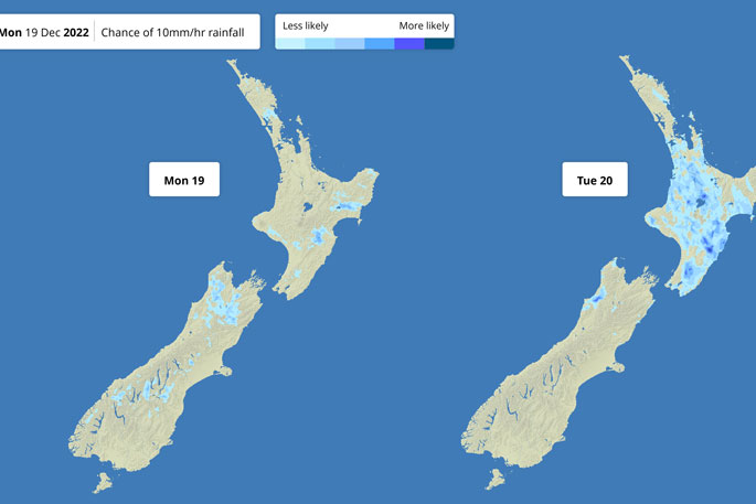 Image: MetService.

0 comments
Leave a Comment
You must be logged in to make a comment.