MetService says a low pressure system over the upper North Island is drifting westwards during today and Monday and will be slowly weakening.
"This weather system brings a moist east to northeast flow to northern and central New Zealand," says a MetService spokesperson.
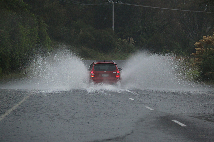
Heavy Rain Watches remain in force for western Bay of Plenty, Gisborne/Tairawhiti, Hawke's Bay and eastern Marlborough.
"There is still uncertainty with the distribution and intensity of the heaviest rain, and people are advised to keep up to date with the latest forecasts in case any changes are made or new areas are added."
Heavy Rain Watch
Area: Bay of Plenty from Edgecumbe westwards
Valid: 22 hours from 8:00am Sun 18 Jun to 6:00am Mon 19 Jun
Forecast: Periods of heavy rain. Rainfall amounts may approach warning criteria. Thunderstorms are possible.
Area: Gisborne/Tairawhiti, also the Wairoa District northeast of Nuhaka
Valid: 34 hours from 8:00am Sun 18 Jun to 6:00pm Mon 19 Jun
Forecast: Periods of heavy rain. Rainfall amounts may approach warning criteria, especially about the ranges. Thunderstorms are possible.
Note: The Wairoa District northeast of Nuhaka is now included in this Watch.
Area: Hawke's Bay south of Te Pohue
Valid: 37 hours from 8:00am Sun 18 Jun to 9:00pm Mon 19 Jun
Forecast: Periods of heavy rain. Rainfall amounts may approach warning criteria, especially about the ranges. Thunderstorms are possible.
Area: Eastern Marlborough south of Ward
Valid: 25 hours from 8:00am Sun 18 Jun to 9:00am Mon 19 Jun
Forecast: Periods of heavy rain. Rainfall amounts may approach warning criteria.

0 comments
Leave a Comment
You must be logged in to make a comment.