Work on design concepts for the protection of Thames is now underway, following project work indicating that $1billion in assets are at risk over the long-term from the effects of flooding and storm-surge associated with sea-level rise.
Protection was the preferred adaptation pathway for Thames confirmed by community consultation during the Shoreline Management project.
The three-year project examined the risks to the entire Coromandel coastline from the effects of sea-level rise.
Specific actions to manage those risks have now been assessed and ranked, with work to protect Thames among the top priorities.
A governance group to progress the Thames protection work met for the first time this month, made up of representatives from our Council, Ngāti Maru and Waikato Regional Council.
“We know that Thames is especially vulnerable to storm surge and flooding associated with sea-level rise, putting around $1 billion of assets in our township at risk,” says Thames-Coromandel DIstrict Council Mayor Len Salt, who is chairing the Thames Protection and Resilience Governance Group.
“Thames is the economic nerve-centre of our district, home to the bulk of the Coromandel’s service provision, maritime industry, healthcare and business infrastructure. It’s our duty to the entire region to ensure Thames is resilient, and able to grow, for generations to come.”
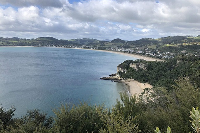
 The three-year Shoreline Management project examined the risks to the entire Coromandel coastline from the effects of sea-level rise. Photo: TCDC.
Royal HaskoningDHV will now proceed with staged design options to protect the township against coastal inundation for a 1 per cent AEP storm over the next 100 years.
An earlier feasibility study showed the main challenge associated with protecting Thames is the required cost and scale of any defensive structures, as many locations are low-lying.
Design work will include full hydrodynamic modelling, and joint probability analysis of coincident coastal and fluvial flooding events.
The governance group notes that it will be important that any protection structure connects with other stormwater and river management work.
Funding for the design work, and ensuing community consultation on design options, is allocated through 2023-2024 Long Term Plan, with funding for the construction of protection yet to be determined.
“We’re going to come up against some big costs, but those need to be assessed against the value of what’s at risk,” says Mayor Len Salt.
“We’re facing up to these challenges head-on, and doing the forward-thinking, groundbreaking work that’s required, rather than just hoping the issues somehow go away. It’s a multi-generational vision and long-term action plan.”
Public consultation on the design concepts is expected in May.
For more information, visit the council's Shoreline Management Pathways project web page.

1 comment
The Master
Posted on 17-03-2024 11:00 | By Ian Stevenson
Taking on mother nature, the inevitable... land rises, land erodes... that has always been so and will always be so...
Recommendation, get out of her way.
Leave a Comment
You must be logged in to make a comment.